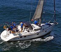
 In the early morning hours of April 28th, the yacht Aegean disappeared and sank in the Newport to Ensenada Race. Wreckage of the sailboat and the bodies of the fours sailors who had been aboard were subsequently found nearby. After initial speculation that there had been an explosion or that the sailboat had been run down by a commercial vessel, the log of an online tracking GPS tracking system suggested that the 37-foot Hunter 376 sailboat had struck the rocks on North Coronado Island. Yesterday, US Sailing’s Independent Review Panel concluded that a grounding on North Coronado Island was the cause of the accident. A full report from US Sailing is expected by July.
US Sailing Independent Review Panel Makes Discovery in Newport to Ensenada Race Tragedy
Not everyone is satisfied with the panel’s conclusion. As reported by the Daily Breeze.com: Anna Mavromati, daughter of the yacht’s captain, Theo Mavromatis, said her family believes the findings are premature and not accurate. “It came as a shock,” said Mavromati, 24, who learned of US Sailing’s announcement in news reports. “I don’t think they have sufficient evidence to make the claims they are making.”

This is tragic. Four lives lost. As we prepare for the N2R race from which i have taken a long leave, i have read the findings of this fatal crash a couple of times. We should always learn from the mistakes of others rather than make the same ourselves. I drew my own conclusions from the report. The point of the report from my perspective is for others that follow to learn from this tragic situation and reduce the chances of experiencing the same fate.
The Coronado islands lights do not shine to the north. The Charts are clear about this. The first time i did this race with a very early GPS in 1996 i set two courses inside and outside these islands. The way point of that decision if unheeded would have had us sail onto the shore of the northern island. The GPS in 1996 was pretty crude by comparison. We did not sleep. it was dark. the wind came from off shore, we headed outside from that way point.
My take away from the account of the Aegean: Everyone must know how to use the GPS and what is telling you. Personal responsibility. the GPS does not sail the boat. the Crew does. Not to mention plotting your position on the chart. It is hard to imagine an alert skilled crew using all of the electronics and prior race knowledge available on Aegean did not know there were approaching the island.