
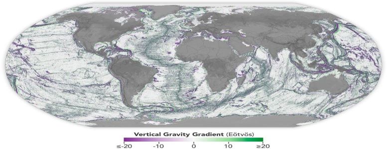
Graphic: NASA Earth Observatory
For decades, we have more detailed maps of the Moon’s surface than Earth’s ocean floor. Although ships equipped with sonar can capture highly detailed images of the seafloor, only about 25 percent of the ocean has been mapped this way. Scientists have long been working to do better.
Now, a NASA-supported research team has taken a major step forward by creating one of the most detailed maps of the seafloor to date, using data from the SWOT (Surface Water and Ocean Topography) satellite.
One of the most striking discoveries made through the SWOT satellite’s observations is the discovery of nearly 100,000 seamounts beneath the ocean’s surface.
 Today, April 11th, is
  Six people died when
  A wonderful story reported by the BBC.
  In February, we

 We recently
 Last week, Trump’s Defense Department removed
  Five years ago,
  A remarkable story of survival against all odds.
  British unmanned systems manufacturer
  Many have dismissed
  The battleship
  This morning, the 804 TEU
  As the current administration launches a frontal attack on diversity, equity, and inclusion, it is a good time to remember
  The iconic passenger liner
 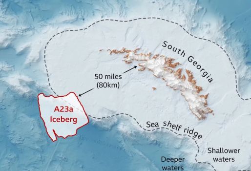 The world’s largest and oldest iceberg, designated
  Yesterday,