
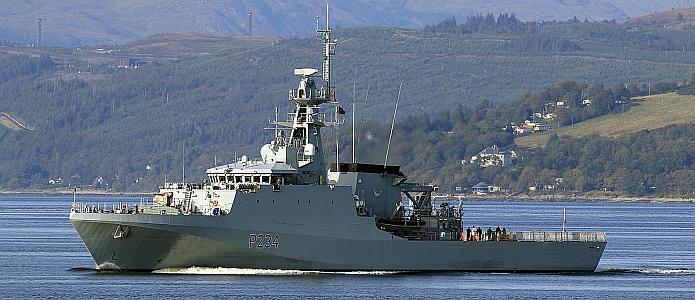
HMS Spey
The Royal Navy patrol ship HMS Spey was on a mission to check and update charts of waters around British Overseas Territories scattered around the globe. It recently observed that Henderson Island in the South Pacific is one mile south of the position marked on charts used by mariners the world over since 1937.
The notes on the chart say that it was produced in 1937 from aerial photography, which implies that the aircraft which took the photos was slightly off in its navigational calculations.
Now, one nautical mile is not very far off, particularly when determined by using a sextant. Only about 14 square miles in area, Henderson Island is also uninhabited and quite remote. It is one of four islands in the Pitcairn chain. Chile lies 3,600 miles to the east and New Zealand 3,200 miles to the southwest.
To put the navigational error in a historical context, it is notable that Henderson Island is one of four islands in the Pitcairn chain. Pitcairn Island, known as a refuge for mutineers from HMS Bounty in 1790, proved to be, inadvertently, an excellent hiding place, due to a charting error.
When Pitcairn Island was first plotted in 1767 by Captain Philip Carteret in command of the British sloop HMS Swallow, he made an error in its position of 3 degrees of longitude or 188 nautical miles to the west of the island’s actual position. The error made the island devilishly tricky to find. Even the notable navigator Captain James Cook failed to find it when he came looking in 1773.
Despite the Royal Navy dispatching ships to find the mutineers, they remained undetected for 18 years, until discovered by the American sealing ship Topaz in 1808.
Thanks to Alaric Bond for contributing to this post.
Thank you for this fascinating article!
So very interesting. Thank you Alaric Bond for your contribute!