
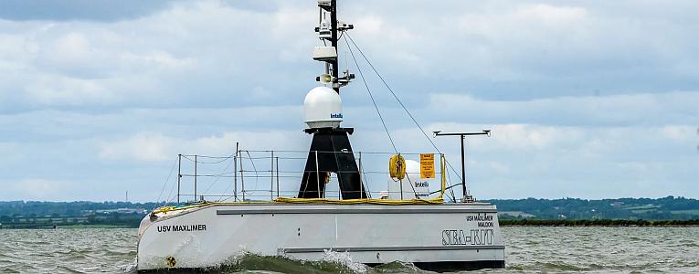
 Last January, a major underwater eruption of the Hunga-Tonga Hunga-Haʻapai (HTHH) volcano caused a tsunami that hit the Pacific country of Tonga. Now, the BBC reports that a robot vessel, the 12m-long Uncrewed Surface Vessel (USV) Maxlimer, has returned from an initial survey, having completed a partial mapping of the opening, or caldera, of the underwater volcano.
The Maxlimer may be in Tonga, but it is being remotely controlled from 16,000km away in the small coastal village of Tollesbury in Essex. Everything is done over a satellite link.
In a dark control room, several large screens display live feed images from the 10 cameras on board Maxlimer. Operators, who work in shifts around the clock, watch as real-time data gets beamed in from the South Pacific.
The vessel, developed by the British company Sea-Kit International, is surveying the volcano as part of the second phase of the Tonga Eruption Seabed Mapping Project (TESMaP), led by New Zealand’s National Institute of Water and Atmospheric Research (Niwa) and funded by the Nippon Foundation of Japan.
Ashley Skett, director of operations at Sea-Kit, told BBC Radio 4’s Inside Science program that the operators can even communicate via radio with other vessels in the area, so much so that other boats wouldn’t know that nobody was on board Maxlimer.
“The boat has been designed from the ground up to be remotely controlled and remotely operated. So every switch, every function on the boat, every light, we can control from here.”
Robotic, remotely controlled boats are likely to be the future of maritime operations. When surveying a dangerous area such as the active HTHH volcano, remote control ensures no crew are put in harm’s way.
Thanks to Alaric Bond for contributing o this post.